

After what had been an incredibley difficult couple of weeks, both professionally and personally, being on the moors, corner of no and where was pretty much all that had been on my mind since my trek of The Welcome Way had been rained off as part of said difficult two weeks. I had planned to attempt The Welcome Way again this week, however, a friend has decided she would like to partake in my hiking madness on that one, so instead, on a particularly overcast (but not raining!) Saturday, I embarked on the Bradford Millenium Way. Even I didn’t think I could complete the whole 45 mile route, which takes in Shipley, Ilkley, Addingham, Silsden, Haworth, Oxenhope, Denholme, Bingley and more in a circular trek around the Bradford Metropolitan District. Never one to be deterred, I set off anyway, bags packed full of snacks and extra socks and armed with a map of the route and an OS map.
Having perused the web for the correct route to follow, I picked a starting point at Hirst Wood Locks as being the easiest to get to and back from, should I make it the whole way around, and headed there at a distinctly unreasonable hour of the morning for my day off! From there I headed across the canal and river towards Higher Coach Road and up onto Shipley Glen, a favourite haunt of mine from my childhood and to this day. I walked across the glen, passing the old quarry, through some woods and fields across Glovershaw Lane until I eventually found myself heading up Birch Close Lane towards Weecher Reservoir, where I met some adorably friendly sheep. I soon found that, despite checking the correct direction to head around the route online (anti-clockwise the site said), all the way markers pointed clockwise, so I had to rely on my maps to ensure I didn’t stray off the path.


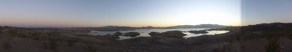
A slightly hairy walk along a national speed limit country road with no path, past an old ruined farm building, and I was up and out onto the moors at last. Starting on Bingley Moor I crossed this and headed towards a very windy Burley Moor where I strayed a little off track due to the above mentioned lack of directional way markers, but I soon found my way down towards Ilkley, across Carstone Beck and along some very treacherous cliff face where I fought with the wind for my life, before reaching Ilkley Craggs, finally stopping at Backstone Beck for the breakfast I had been hoping for for some time. Here I sat on a rock, rested my feet and enjoyed a snack bar and some dried fruit. A veritable feast!


After a short break I carried on, a steep climb up towards Ilkley Crags and then back down again towards White Wells where I found a very welcome public toilet before continuing along the Dales Highway across Ilkley Moor and following this for some time onto Addingham Moor where I truly found myself in the wildnerness with little evidence of civilisation amidst some spectacular views.


Following the Dales Highway some more I eventually turned off at Milestone Humps where the steep sloping path took a particularly hairy turn crossing some rocks which were like to send me hurtling to my death with just one slip of the foot, before taking me across some fields and onto Moorside Lane, Addingham where I found the cutest little street and some very friendly cows.


The path then lead me through a whole load of fields with some rather tricky stiles towards Cocking Lane. As I had rather been hoping to stop for lunch and a rest, but had found no particularly good spot for miles and it was now getting towards 3pm, I chose the top of one of the stiles as my rest point where I took a break watching some cows grazing and munched on my well earned wraps. After a good rest the walk took me through more fields into Addingham itself, where I hit a slight snag with the path being blocked off for tree felling. I found a way around though and headed along Parsons Lane for some distance which took me across Addingham Low Moor and on towards Silsden. Leaving the track I crossed more fields, and maybe it was just because I was tired and the light was failing, but by this point I had become rather bored of having to constantly refer to the map to figure out which direction to head across the field to the stiles due to the path only being waymarked in the opposite direction.
Eventually, I made it out onto Bolton Road at Silsden where I decided to end my walk for the day, having made it about half way through.
If you are interested in doing the walk, guidebooks (which I should have bought) can be found here and PDF maps of the route are available as an OS and Open Street Map here.
Check out my route below:
